
Prickey Sithy, Caernarfon
This strange street name has long since disappeared. It was recorded by the cartographer John Speed on his 1610 map of Caernarfon. It is marked C on the map, shown here courtesy of the National Library of Wales – Llyfrgell Genedlaethol Cymru.
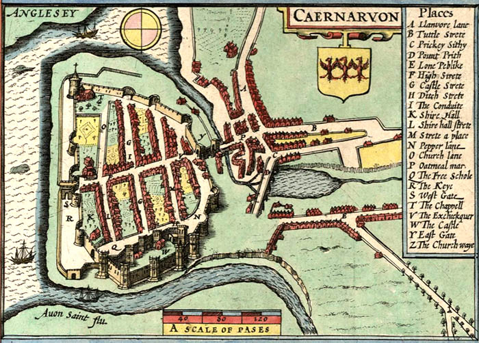 The street is now called South Penrallt (De Penrallt). It led to Twthill before the inner relief road was built in the 1970s.
Prickey Sithy was an anglicisation of priciau saethu – the archery ground (literally: “shooting sticks”). The name was noted as “South Pen yr allt, formerly called Stryd y Priciau Saethu” in an 1821 document by PB Williams, rector of Llanddeiniolen.
It’s believed that medieval archers may have walked this way to practise archery. It was important that they were skilled with bow and arrow in order to defend the town. There’s evidence of this in the muster list of 1531, which notes that boys aged over 16 years were compelled to serve the king. They had to swear to turn out, with an hour’s notice, for inspection, drill or marching.
With thanks to Caernarfon Civic Society. Sources include 'Old Caernarvon – Outside the Town Walls', by KF Banholzer.
Postcode: LL55 1NS View Location Map